Our People
Get a glimpse into some of the careers at EDF power solutions!
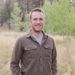
Raised outside Portland, OR, by parents who were both teachers, Brendan Soule developed an appreciation for the value of helping people learn. “It’s something that was modeled for me from an early age, and I naturally internalized the desire to share knowledge and information with others,” he reflects.
Brendan sees a direct connection between this and his chosen field of GIS (geographic information systems), a technology used to create, manage, analyze, and map all types of data. GIS has a vast array of applications, including many related to renewable energy development – and in his 15 years with EDF power solutions North America, he’s helped solve a wide range of challenges, in many cases by custom designing tools.
While earning a degree in geography and a GIS certificate from Oregon State University, Brendan got involved in IT through a part-time job in a campus computer lab. From there he advanced to providing IT support for the College of Engineering. “That’s when things started to solidify for me,” he remembers. “I saw the power of combining geography and location with IT, and I realized, ‘This is what I want to do.’”
After graduating, Brendan worked briefly for Oregon’s Department of Transportation helping to ground-truth bridge locations for the state’s GIS dataset. Next he took a position with the Columbia River Public Utility District (PUD). “That’s how I got into the energy sector, and it was a great opportunity to gain new skills and experience because there were so many different ways to use and apply GIS,” he says.
While he was satisfied with his role at the PUD, a GIS Technician position opened with EDF’s predecessor enXco – which at the time had an office in Portland – after about two-and-a-half years. Brendan felt that “the stars had aligned. I remember thinking, ‘This is the perfect job for me – if I could design a job for myself, this would be it.’”
Brendan credits his upbringing with his interest in renewable energy. “My parents were very eco-conscious, and my sister and I grew up understanding that we have to care for the environment and not waste resources,” he recalls. “The idea of living sustainably and reducing our impact on the world was just part of our family’s lifestyle, so I saw renewables as the way forward and the right thing to do.”
After less than two years as a GIS Technician supporting GIS analysts in different regions in the US, Brendan advanced to being a GIS Analyst himself. “As an analyst, you’re the GIS point-of-contact for specific projects, and in my case, they were Canadian wind. This introduced a bit of a learning curve since some of the parameters are different in Canada. And a few years later, the company’s development focus began transitioning to solar, which brought its own nuances relative to wind.”
While there are a multitude of ways in which GIS can be used to present project-related information, in the early stages of project development the first step is identifying a potential footprint. “We start with a big area of land and apply various data sets, or ‘layers,’” Brendan explains. “These layers include things like roads, structures, and culturally or environmentally sensitive areas. Once we’ve identified areas that aren’t suitable, we’re left with areas of land that might be suitable.”
Working closely with project developers, the next step is for the GIS team to drill down and contribute to deeper analyses that determine resource availability, access to transmission, and so on. “We also provide data and information to stakeholders outside EDF,” Brendan clarifies. “Utilities, government agencies, county offices and others all require GIS information about proposed projects.”
After several years on the GIS team, Brendan and others began to feel a more standardized approach across regions was needed, and this led to his next position as Senior GIS Analyst – Tools & Methods. “Different parts of the country had their own way of doing things. There wasn’t a lot of cross-communication or sharing of best practices. I focused on centralizing our GIS data and standardizing processes and workflows to make them more uniform and efficient.”
While the standardization initiative requires ongoing effort, the value of having a uniform approach was recognized and embedded by 2023. It was around this time that the GIS team underwent another reorganization to create a dedicated group focused on customized GIS applications, separate from the team members working to support project development.
“Project development involves threading the needle among a lot of complex systems. The power of GIS is that it distills huge amounts of information down to intuitive visuals that reveal insights that would otherwise be hidden.”
Brendan heads this team and sees its work as an important part of the company’s digital transformation. “Project development involves threading the needle among a lot of complex systems. The power of GIS is that it distills huge amounts of information down to intuitive visuals that reveal insights that would otherwise be hidden. It also offers tremendous flexibility – you can slice and dice data and give people multiple ways to access the same information.
In addition to being a GIS guru, husband, and father to two children, Brendan is an avid long-distance runner. He completed his third 100k (63-mile) race in April 2025 and is currently training for his second 100-mile run this October. “Work, family, training – it’s a lot to juggle!” he concedes, but he finds running meditative and sees a lot of similarities between it and his work.

“Running has taught me that there aren’t any shortcuts. Success requires a methodical, consistent approach – each little brick you put in place adds up to become a structure. The same is true with GIS – there are many opportunities to fix things and introduce improvements, but we can’t do everything, and the timing isn’t always right. We must be patient and wait for things to progress, understanding that we won’t necessarily advance in a straight line.”
“I can’t imagine feeling this motivated working in a different industry. Contributing to something positive, doing something that matters, that’s what resonates for me.”
Brendan draws inspiration from knowing that he’s helping to map a clean energy future. “GIS is used in so many sectors, but I can’t imagine feeling this motivated working in a different industry. Contributing to something positive, doing something that matters, that’s what resonates for me. Seeing an operating wind or solar project my team and I supported is incredibly rewarding because it’s tangible evidence that our work is making a difference in the real world.”